
Vietnam is a paradise for hikers. A world away from the chaos of the major cities, there is a variety of trails, mountains and endless nature waiting to be explored.
Whether it is summiting Fansipan mountain, exploring rice terraces and surrounding villages or delving into some of the world’s biggest caves in Phong Nha, there is a staggering range of outdoor adventures available.
One area of natural beauty that is often overlooked in Vietnam is the south. It may not possess the impressive karst limestone landscape synonymous with the mountainous north or the picturesque evergreen trees of central Vietnam, but there are several hiking gems hidden within the relatively flat region around Ho Chi Minh City.
Black Virgin Mountain (Ba Den)
Let’s start with the highest peak in southern Vietnam, Ba Den or Black Virgin Mountain in Tay Ninh Province.
|
|
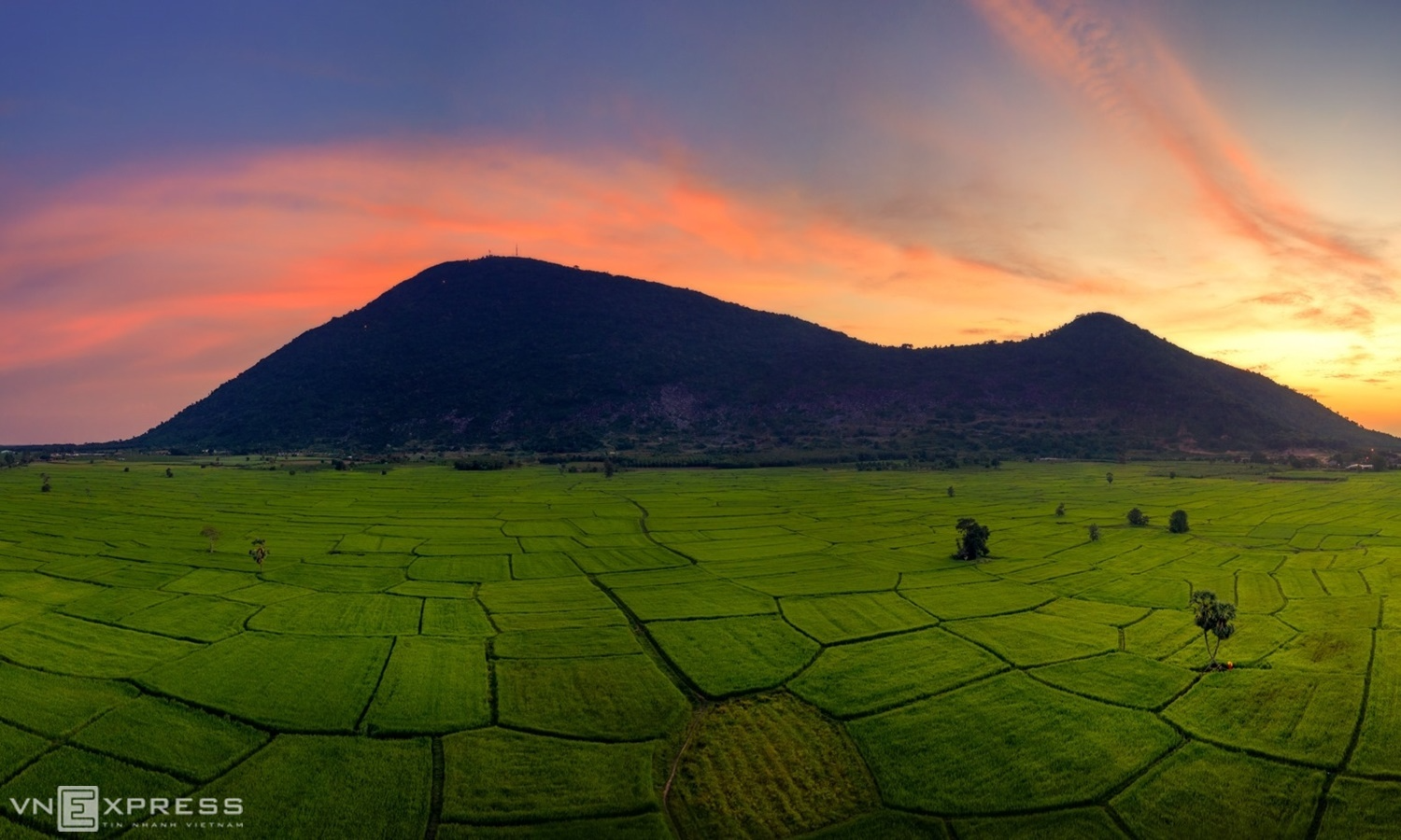
Ba Den Mountain next to rice fields in Tay Ninh Province. Photo by Nguyen Tan Tuan |
The extinct volcano’s summit may only be 996 m above sea level, yet it presents a challenging, rewarding hike for those who opt to ascend on foot, rather than the cable car that is available. The most popular route for hikers begins near Martyrs’ Monument and follows power lines that guide explorers as they make their way up the rocky trail. Despite the considerably lower elevation compared to the mountains in Lai Chau or Lai Cao in northern Vietnam, there are different challenges, such as the little shade available and absence of food/drink/rest stations on the way up.
Although, those who find the hike particularly tiring can conveniently choose to take the cable car down instead of descending on foot. Those who trek both ways can embrace the challenge of some slippery rocks and may even spot some of the venomous snakes or colourful geckos endemic to the area.
Chua Chan
|
|
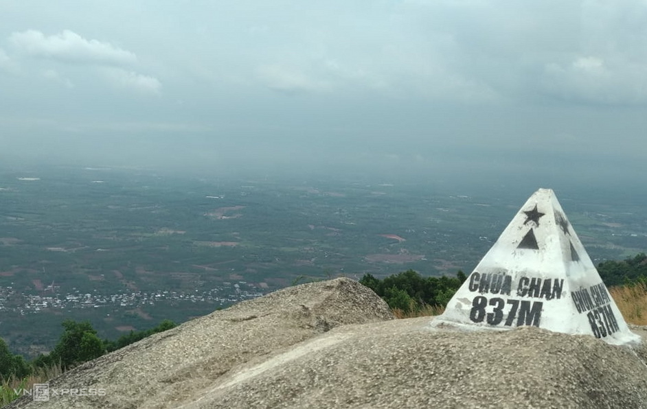
Chua Chan Mountain Peak in Dong Nai Province. Photo by VnExpress/Phuoc Tuan |
Chua Chan mountain is located further east in Dong Nai Province and, with a peak of 837 m, is the second highest mountain in the south. The area is enveloped with lush greenery and has become a well-known camping spot for weekend trips, particularly for Saigon residents who can reach the mountain in approximately three hours.
Similar to Black Virgin Mountain, the most popular route for hikers is mapped out by power lines that are conveniently numbered, offering visitors a clear insight on how far they have covered whilst ascending and descending. One unfortunate note for both Chua Chan and to a lesser extent at Ba Den, is the amount of litter that has accumulated in some areas, particularly near the summit of this mountain where campers have seemingly neglected clearing up after themselves.
Cat Tien
Arguably the most famous national park in southern Vietnam with an abundance of rare species and endemic genes of fauna and flora, Cat Tien is a ideal playground for nature enthusiasts.
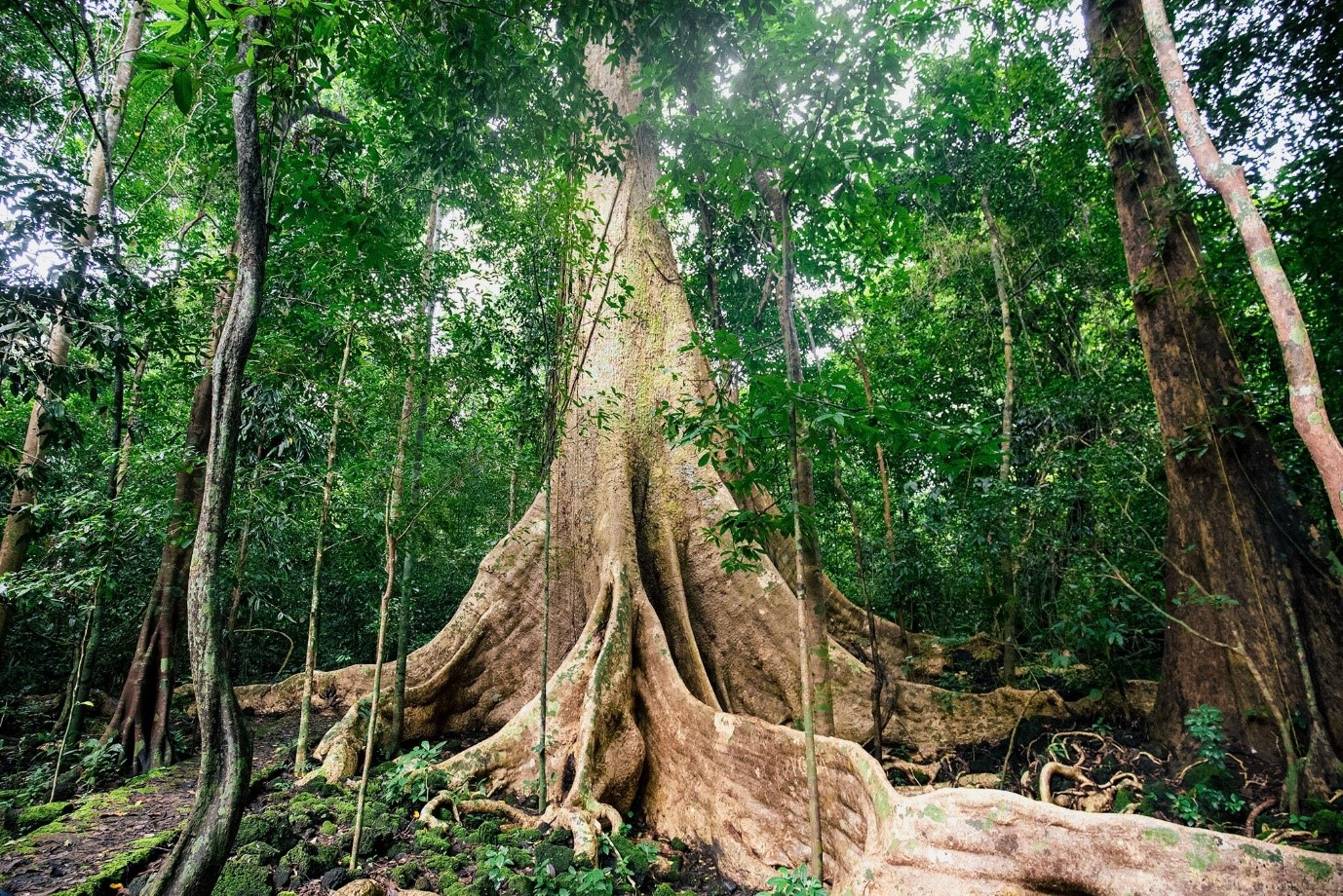
The UNESCO biosphere reserve has a plethora of hiking options that are conveniently detailed in the maps you can pick up from the park headquarters. The most popular trails include the early morning gibbon trekking tour where adventurers closely follow the bellowing call of the lesser-ape species. For those who want to venture further into the lowland tropical forest, you can enjoy taking photos with the ancient giant
tung
tree said to be more than 400 years old, or the special
bang lang
tree with 6 separated trunks. There is also the option to visit Ben Cu waterfall or Ta Lai ethnic village further away from the center of the park.
|
|
The giant 400-year-old tung tree at Cat Tien national park. Photo provided to VnExpress |
Dinh
Even closer to Vietnam’s biggest metropolis is Dinh Mountain, a rare area of high ground that rises above the vast area of river deltas in Ba Ria – Vung Tau.
The well-kept trail is a peaceful retreat away from the city and is extremely popular on weekends, due to its close proximity to HCMC. The nearby streams, Suoi Da and Suoi Tien, also contribute to its popularity, where the freshwater forms multiple natural pools that are frequently filled with locals bathing and swimming.
|
|
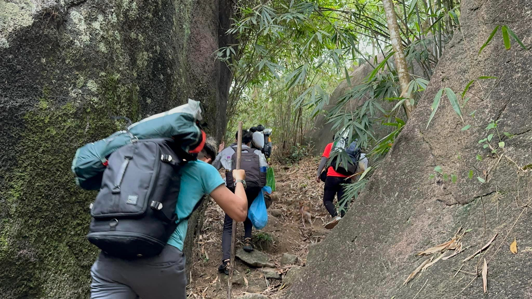
A group of trekkers climb up Dinh Mountain in Ba Ria-Vung Tau. Photo by Nguyen Duong Tien |
The Buddhist temples amongst the dense foliage, along with the eucalyptus trees as you approach the mountain help add to the serene atmosphere of the area but hikers should also be wary of the treacherous nature of the slopes, particularly during the rainy season.
Ta Nang – Phan Dung
This multi-province hike can start in Binh Thuan Province’s Tuy Phong District and concludes around 35 km further north within Duc Trong District in Lam Dong.
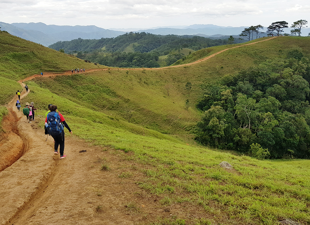
|
|
Trekkers on Ta Nang – Phan Dung route. Photo by Nguyen Sy Duc |
The trail is a stunning journey with panoramic views of forests, hills, and rivers. While the scenery is incredible, the path can be tough, muddy, steep, and often slippery, especially after rain.
Unlike the previously mentioned hikes, a guide is essential to navigate the remote areas and ensure safety, as the trail can be tricky to follow. Despite the challenges, the experience of trekking through untouched nature makes it a rewarding adventure for those up for the challenge. The route typically takes 2 to 3 days to complete, depending on the pace and amount of stops, however the opportunity to experience a slower pace of life and see the homes of ethnic groups like the K’ho and Churu, certainly makes for a unique cultural experience in nature.


