
Spectacular satellite images shows Mount Etna erupting.
At 11:24 am local time on 2 June, the most active volcano in Europe produced a spectacular eruption, propelling a dense column of ash and smoke several kilometres into the atmosphere.
According to Italy’s National Institute of Geophysics and Volcanology (INGV), the eruption at the Sicily formation originated from the South East Crater, one of the most active summit vents in recent years. The event was characterised by vigorous Strombolian activity, lava effusion, and a pyroclastic flow.
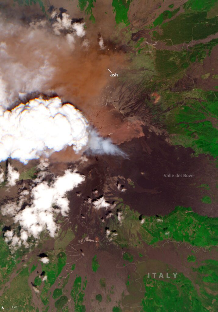
The European Commission’s Copernicus Sentinel-2C satellite acquired images of the area just minutes after the onset of the eruption.
The first natural colour image clearly depicts a dense ash plume in the summit crater area, partially obscured by a pyrocumulus cloud drifting westward towards inland Sicily.
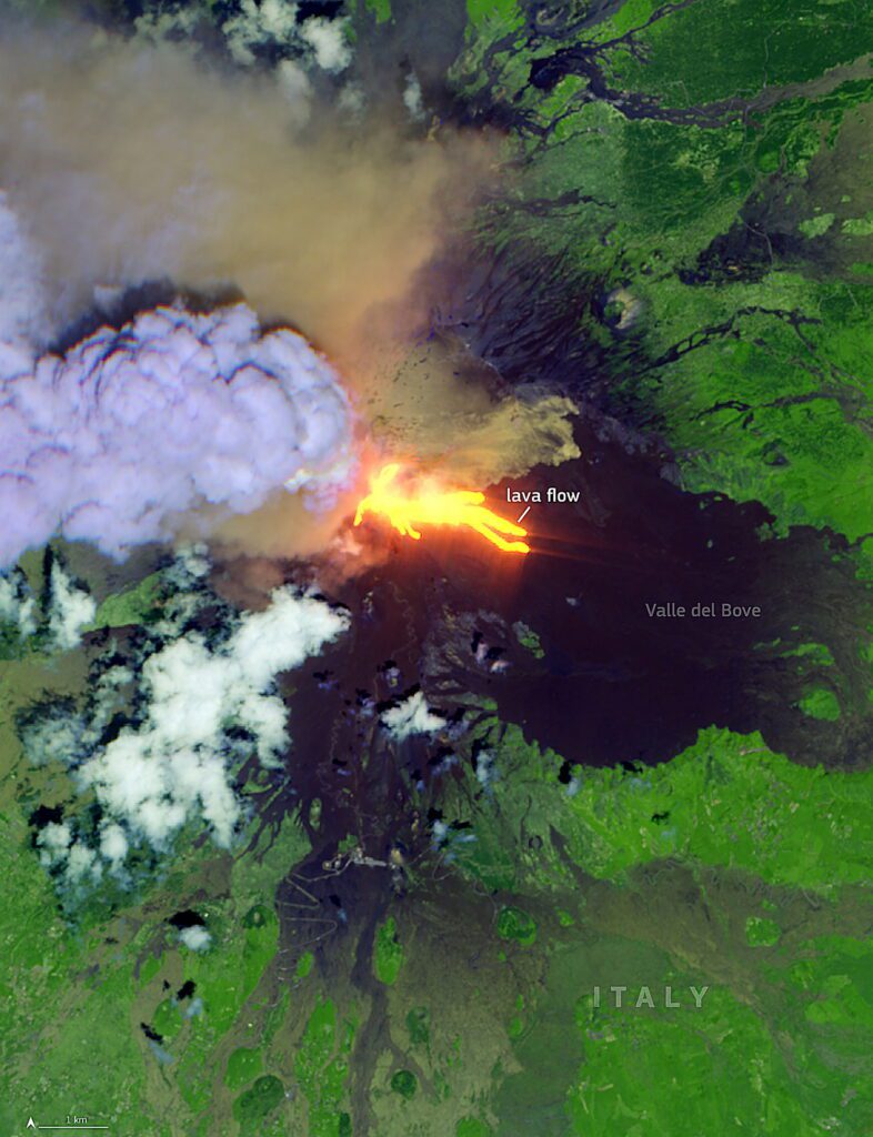
The second, a false colour composite using shortwave infrared channels, reveals the intense thermal signature of active lava flows descending into the Valle del Bove.
Copernicus data tracks global volcanic activity, and helps communities to assess hazards, support emergency response operations, and monitor long-term changes to landscapes.


