Unprecedented Cold Fronts Sweep Across Australia
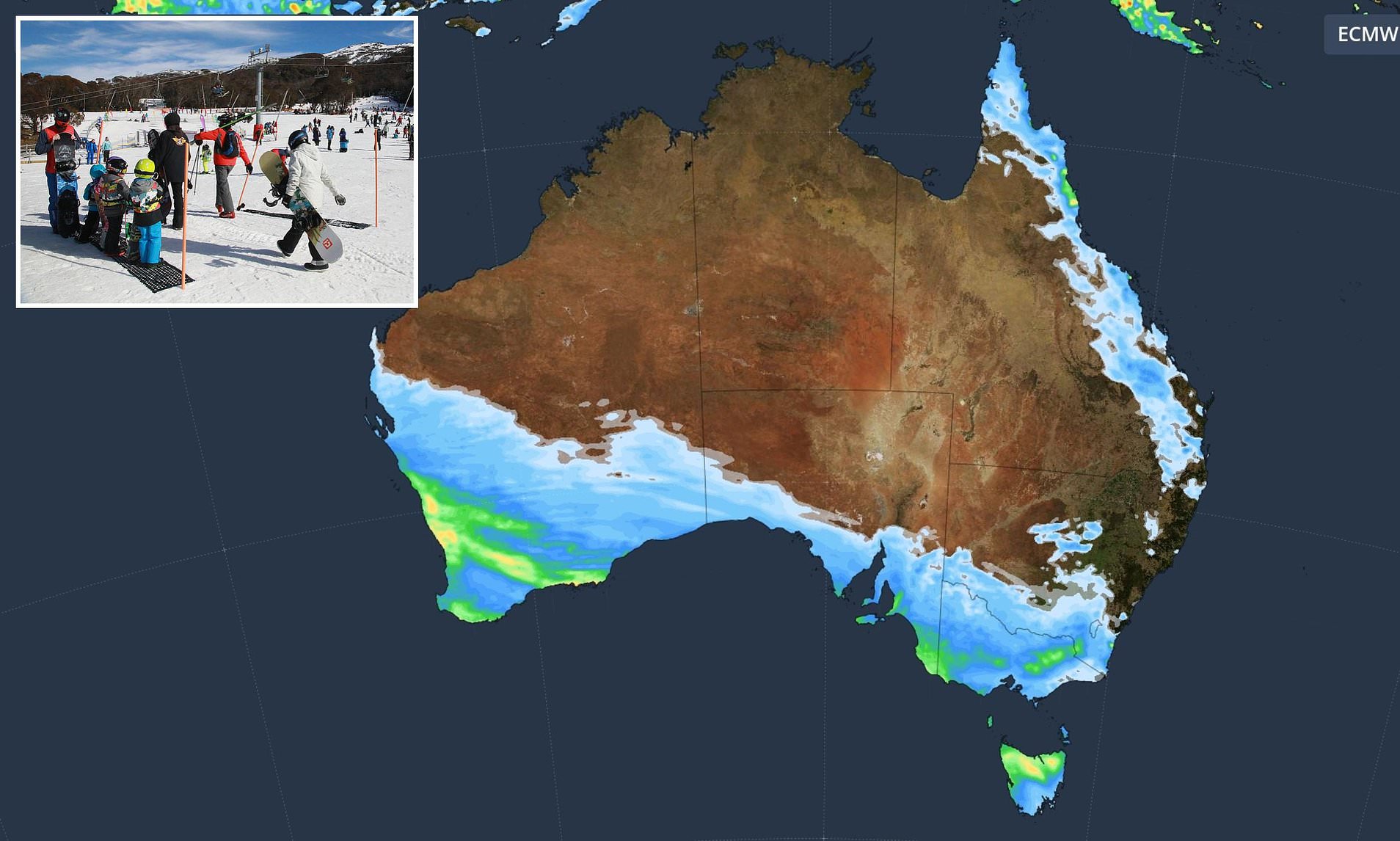
Australia is experiencing a series of powerful cold fronts that are dramatically altering the weather patterns across the southeast. These systems are bringing with them a mix of rain, strong winds, and icy conditions, which have already started to impact various regions. The effects are expected to intensify in the coming days, with some areas facing snowfall and challenging weather conditions.
Impact on Western Australia
The first of four cold fronts made its way into southwest Western Australia on Sunday, delivering heavy rain and wind gusts exceeding 120 km/h. This initial system has already caused disruptions in the region, setting the stage for more severe weather in the days ahead.
Expanding Influence on Southern States
A second cold front, driven by a low-pressure system, is set to affect South Australia, Victoria, Tasmania, and New South Wales starting from Tuesday. Meteorologists predict snowfall ranging from 10cm to 30cm in the alpine regions, particularly in Victoria. Meanwhile, low-lying areas will face strong winds and rain, creating potential hazards for residents.
According to Dean Narramore from the Bureau of Meteorology, the primary concern from this weather front is the strong to damaging winds. He warned that these winds could lead to fallen trees, powerlines, and property damage. Residents in coastal and elevated areas are advised to take precautions, such as securing loose items like trampolines to prevent them from being carried away.
Additional Cold Front Expected
A stronger cold front is anticipated on Wednesday, which will bypass southwestern WA but directly impact the southeast with cold and windy conditions. Snowfall is expected in areas like Mount Lofty, just 25 minutes from Adelaide’s central business district. Weatherzone also noted that the Flinders Ranges in South Australia could see snowfall if sufficient moisture reaches the area.
In NSW and Victoria, the heaviest snowfall is expected in the alpine regions, with predictions of 20cm to 40cm of snow. Snowfall at elevations as low as 800m is possible, and elevated areas such as the NSW Central Tablelands can also expect snowfall.
Weather Outlook for Key Cities
Sydney
- Tuesday: Mostly sunny. Min 7°C. Max 19°C.
- Wednesday: Mostly sunny. Min 10°C. Max 19°C.
- Thursday: Becoming windy. Partly cloudy. Min 9°C. Max 18°C.
Perth
- Tuesday: Showers. Min 7°C. Max 16°C.
- Wednesday: Sunny. Min 6°C. Max 18°C.
- Thursday: Sunny. Min 5°C. Max 19°C.
Melbourne
- Tuesday: Showers increasing. Windy. Min 9°C. Max 14°C.
- Wednesday: Shower or two. Min 7°C. Max 12°C.
- Thursday: Showers. Min 7°C. Max 11°C.
Hobart
- Tuesday: Shower or two. Min 5°C. Max 14°C.
- Wednesday: Possible shower. Min 6°C. Max 12°C.
- Thursday: Shower or two. Min 4°C. Max 12°C.
Canberra
- Tuesday: Morning frost. Shower or two. Min 0°C. Max 13°C.
- Wednesday: Morning frost. Partly cloudy. Min 0°C. Max 11°C.
- Thursday: Showers. Min -1°C. Max 9°C.
Brisbane
- Tuesday: Sunny. Min 9°C. Max 22°C.
- Wednesday: Mostly sunny. Min 9°C. Max 25°C.
- Thursday: Mostly sunny. Min 13°C. Max 23°C.
Darwin
- Tuesday: Sunny. Min 21°C. Max 32°C.
- Wednesday: Sunny. Min 20°C. Max 30°C.
- Thursday: Sunny. Min 19°C. Max 31°C.
Adelaide
- Tuesday: Cloudy. Very high chance of rain. Min 10°C. Max 15°C.
- Wednesday: Cloudy. Very high chance of showers. Min 9°C. Max 13°C.
- Thursday: Cloudy. Very high chance of showers. Min 8°C. Max 14°C.
Weather Trends in Northern Australia
In contrast to the southern states, northern Australia is experiencing a high-pressure system that is leading to clearer and drier conditions. Much of Queensland is expected to see “completely cloudless” skies throughout the week, offering a stark contrast to the weather in the south.


