Severe Weather Conditions Across Ireland and Northern Ireland
Parts of Ireland experienced significant weather challenges on Monday morning, with orange-level weather warnings in effect due to a night of heavy rainfall across the island. This followed a series of weather alerts issued on Sunday, which highlighted unseasonably high levels of precipitation that continued into the early part of the week.
An orange-level rain warning was active for several regions, including Dublin, Louth, Meath, and Wicklow. The warning was in place from midnight and was set to expire at 2pm on Monday. The Irish national forecasting agency, Met Eireann, reported that persistent and heavy rain, along with the possibility of thunderstorms, would continue throughout the period.
Kildare was also under a yellow-level rain warning for the same duration. These alerts came after previous warnings about thunderstorms in the eastern parts of the country and increased rainfall in the south-west. Met Eireann warned that the weather conditions could lead to widespread surface flooding, extremely difficult travel conditions, lightning damage, and very poor visibility in the most affected areas.
On the other side of the border, the Met Office issued a yellow-level rain warning for the east coast of Northern Ireland. The region was expected to experience some of the heaviest rainfall until 6pm on Monday. Forecasters noted that affected areas could receive up to half a month’s worth of rain in less than a day. A 24-hour warning was in place for Antrim, Armagh, and Down starting at 6pm on Sunday.
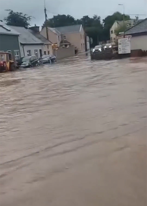
A more intense amber-level warning was temporarily put in place overnight but has since been lifted. However, the risk of flooding remains high, with potential impacts including home and business flooding, power cuts, and dangerous driving conditions. There is also a small chance that some communities could be cut off by flooded roads, with fast-flowing or deep floodwater posing a danger to life.
Simon Partridge, a forecaster with the UK Met Office, stated that Northern Ireland was likely to experience the most significant rainfall. He mentioned that the region could see between 50 to 75mm of rain within 12 to 18 hours. This amount of rainfall is particularly concerning as it exceeds the average July rainfall of 89mm in the region, meaning more than half a month’s worth of rain could fall in a single day.
A yellow-level thunderstorm warning was active for the western half of Northern Ireland between midday and 8pm on Sunday. Flooding had already impacted several routes in Fermanagh on Sunday evening. Roads such as the Marble Arch Road, Florencecourt, and Sligo Road in Enniskillen were described as impassable by police.
A spokesperson from the Police Service of Northern Ireland (PSNI) urged drivers to take care, slow down, and exercise caution on affected roads. With the ongoing threat of severe weather, residents and travelers are advised to remain vigilant and follow local guidance to ensure safety during this challenging period.


