Seismic Activity Recorded in the Andaman Sea
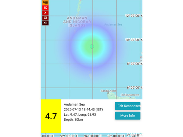
A moderate earthquake with a magnitude of 4.7 on the Richter scale was recorded in the Andaman Sea on Sunday evening, according to a recent report. The event occurred at 6:44 pm IST and was detected at a depth of 10 kilometers beneath the surface. This information was shared through official channels by the National Centre for Seismology (NCS), which monitors seismic activity across the region.
The details of the tremor were provided via a social media platform, where the NCS posted specific coordinates and timing. According to the data, the epicenter of the earthquake was located at 9.47 degrees North latitude and 93.93 degrees East longitude. The location is within the Andaman Sea, an area known for its geological activity due to the tectonic interactions between several plates.
This particular event, while not classified as a major quake, is still significant as it highlights the ongoing seismic activity in the region. Earthquakes of this magnitude are often felt by people in nearby areas, though they typically do not result in widespread damage unless they occur close to populated regions.
Key Details of the Earthquake
- Magnitude: 4.7 on the Richter scale
- Date and Time: July 13, 2025, at 6:44 pm IST
- Depth: 10 kilometers
- Coordinates: 9.47 N, 93.93 E
- Location: Andaman Sea
The NCS continues to monitor the situation closely, and further updates may be released if additional information becomes available. While no immediate reports of casualties or structural damage have been made public, local authorities are likely assessing the impact of the tremor.
Understanding Seismic Activity in the Region
The Andaman Sea is part of a seismically active zone, influenced by the movement of the Indian Plate and the Burmese Plate. This tectonic interaction leads to frequent earthquakes, some of which can be felt across the islands and surrounding coastal areas. Although most quakes in this region are minor, they serve as reminders of the dynamic nature of the Earth’s crust.
Residents in the Andaman and Nicobar Islands are generally well-prepared for such events, as the region has experienced similar occurrences in the past. Emergency response teams and local authorities maintain protocols to ensure safety and provide assistance when needed.
Ongoing Monitoring and Research
Scientific institutions like the NCS play a critical role in tracking seismic events and issuing timely alerts. Their work involves analyzing data from various monitoring stations and using advanced technology to determine the characteristics of each earthquake. This helps in understanding patterns and improving preparedness for future events.
In addition to real-time reporting, researchers also study historical data to identify trends and potential risks. This knowledge contributes to better urban planning, infrastructure development, and disaster management strategies in vulnerable regions.
As more information is gathered, the scientific community will continue to assess the implications of this earthquake. For now, the focus remains on ensuring that the public is informed and that necessary precautions are taken.


