Weather Outlook for the Charlotte Area and Surrounding Regions
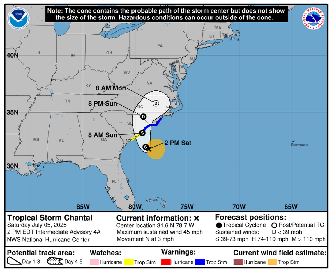
As Tropical Storm Chantal continues to move through the region, its outer bands are expected to bring significant weather changes to areas far from the immediate coastline. A National Weather Service meteorologist highlighted that the storm’s influence could extend as far west as Charlotte, bringing increased chances of showers starting early Sunday.
According to meteorologist Chris Horne, the likelihood of rain in the Charlotte area is expected to rise after sunrise on Sunday. However, at 2:30 p.m. on Saturday, it was still too early to determine exactly where the heaviest rainfall might occur. The storm’s effects will likely be felt across a wide stretch of the Carolinas, with varying intensities depending on the location.
In addition to the potential for rain, the Charlotte area may experience breezy and windy conditions. While wind gusts are not expected to exceed 20 mph, there could be periods of stronger winds. The type of precipitation associated with the storm is similar to what is typically seen with the outer bands of tropical systems—showers that can be strong at times but are not necessarily continuous.
Coastal Impacts and Safety Concerns
While Charlotte and other inland areas may face moderate weather conditions, the worst of the storm is anticipated along the coast. The National Hurricane Center in Miami has warned of scattered flash flooding in the Carolinas due to the storm’s impact. Additionally, life-threatening surf and rip currents are expected along the coastline, stretching from northeastern Florida to the Mid-Atlantic states over the next few days.
Coastal residents and visitors are urged to pay close attention to local advisories and heed the guidance of lifeguards and officials. These warnings are critical, as the combination of high waves and strong currents can pose serious risks to swimmers and beachgoers.
Current Status of Tropical Storm Chantal
As of 2 p.m. on Saturday, Tropical Storm Chantal was located approximately 105 miles southeast of Charleston and 185 miles southwest of Wilmington. The storm was packing sustained winds of 45 mph, indicating its strength and potential for further development. Although the exact path and intensity of the storm are still being monitored, updates are expected as more data becomes available.
Key Weather Considerations
Here are some key points to note about the current weather situation:
- Rainfall: Increased shower chances are expected in the Charlotte area starting early Sunday.
- Winds: Wind gusts could reach up to 20 mph, with occasional stronger bursts.
- Coastal Risks: Life-threatening surf and rip currents are forecast along the Atlantic coastline.
- Flash Flooding: Scattered flooding is possible in the Carolinas due to heavy rainfall.
- Storm Location: As of Saturday afternoon, the storm was positioned 105 miles southeast of Charleston and 185 miles southwest of Wilmington.
This story is developing, and additional updates will be provided as more information becomes available. Residents in affected areas should stay informed through reliable weather sources and follow any official advisories issued by local authorities.


